
Wrangell Narrows Alaska: Wildlife, Scenery & Visitor Guide
Wrangell Narrows near Petersburg, Alaska is a winding marine passage where Southeast Alaska’s scenery and maritime character come together. The channel threads between Mitkof and Kupreanof islands, connecting Frederick Sound in the north with Sumner Strait to the south. Along the way are forested shorelines, mountains, fishing boats, bald eagles and an extraordinary collection of navigation markers guiding vessels through one of the region’s more challenging waterways.
For guests staying at Scandia House in Petersburg, the Narrows aren’t a distant attraction requiring a major expedition. Petersburg sits at their northern end, and the waterway is part of the landscape, transportation network and fishing culture surrounding the community.
Whether you’re exploring by boat, riding the Alaska Marine Highway, fishing nearby or simply interested in the geography that helped shape Petersburg, the Wrangell Narrows are worth understanding.
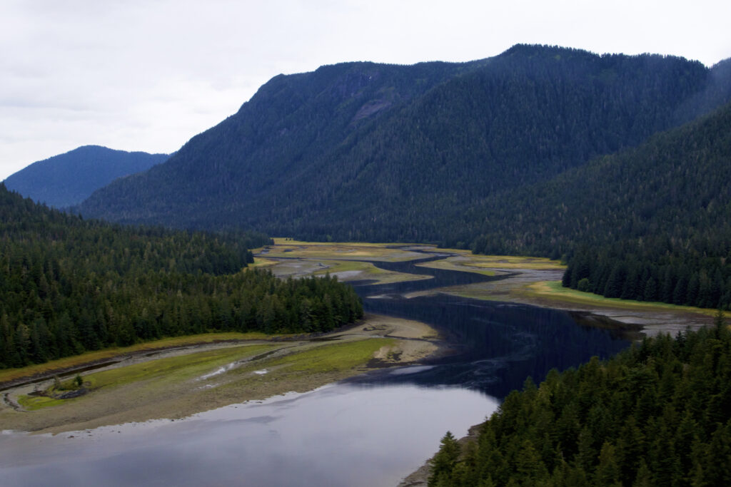
A Winding Passage Through Southeast Alaska
Wrangell Narrows extends for roughly 21 miles between Frederick Sound and Sumner Strait, separating Mitkof Island from Kupreanof Island and, farther south, Woewodski Island.
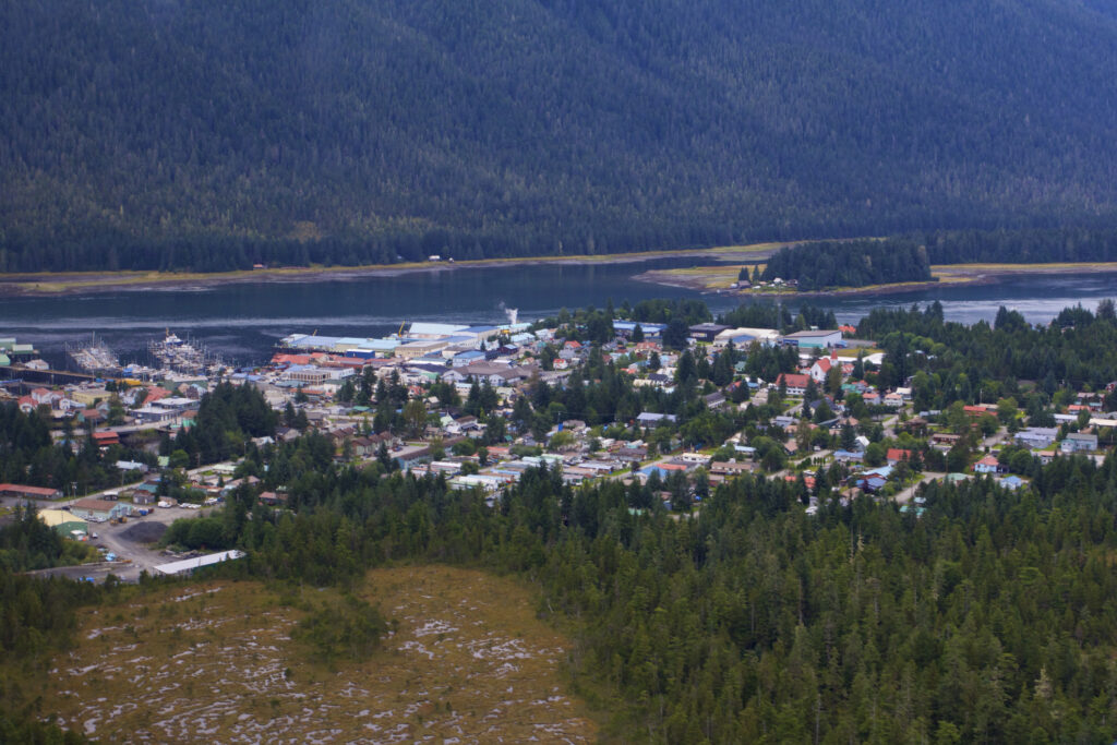
Petersburg sits near the northern entrance.
Calling it a “channel” doesn’t quite capture what the journey looks like. Instead of traveling down a broad, straight waterway, boats follow a route that bends between islands, reefs, shoals and stretches of shallow water.
In places, the shoreline feels surprisingly close. Forests descend toward the water, mountains rise in the distance and houses occasionally appear along sections of the channel.
It’s a very different experience from crossing the wide-open waters elsewhere in Southeast Alaska.
Why Are the Wrangell Narrows So Famous Among Boaters?
For experienced mariners, the appeal comes with a healthy dose of respect.
The Narrows are known for their bends, shallow sections, tidal currents and navigational hazards. NOAA’s Coast Pilot advises mariners that currents vary considerably through the passage, with some locations experiencing particularly strong flows.
That’s why visitors traveling through the Narrows may notice so many navigation aids.
Lights, daymarks and buoys appear repeatedly along the route, identifying the navigable channel and helping vessels stay clear of hazards.
To a passenger, they add character to the scenery. To the person operating the boat, they’re essential information.
You’ll See Navigation Markers Everywhere
One of the most distinctive features of Wrangell Narrows is the sheer number of navigational markers packed into a relatively short passage.
Roughly 60 lights and buoys have historically been used to mark the winding route.
You’ll see red and green aids appearing along the channel, sometimes close enough together to make the path vessels are expected to follow remarkably clear.
This concentration of markers has given the passage one of its most memorable nicknames: Christmas Tree Lane.
The name becomes particularly easy to understand when traveling through the Narrows in low light, when navigation lights punctuate the channel ahead.
Even during the day, watching a vessel carefully follow the marked route gives you a sense of just how different this waterway is from an open bay.
The Tides Can Transform the Passage
The Narrows don’t look exactly the same throughout the day.
Tides expose and conceal shoreline, mudflats and shallow areas while currents move through the channel.
NOAA notes that tidal currents can be significant throughout Wrangell Narrows. Flood currents enter from both ends and meet in the central portion of the passage.
Current speeds vary by location. Around Petersburg, NOAA reports currents reaching approximately 3.5 knots, while stronger sections near places such as Turn Point, Spike Rock and South Ledge can reach 4 to 5 knots. During particularly strong tidal conditions, currents may be even faster.
Those numbers matter primarily to mariners, but visitors can sometimes see their effects in the water.
Moving current, exposed shoreline and the changing position of boats at anchor are all reminders that this landscape is constantly shifting with the tide.
Why the Biggest Cruise Ships Don’t Come Through Here
Wrangell Narrows is an important route through Southeast Alaska, but there are limits to what can safely navigate it.
The combination of shallow water, tight turns and a relatively narrow channel means the largest cruise ships don’t travel through the passage.
Instead, you’ll see vessels better suited to these waters.
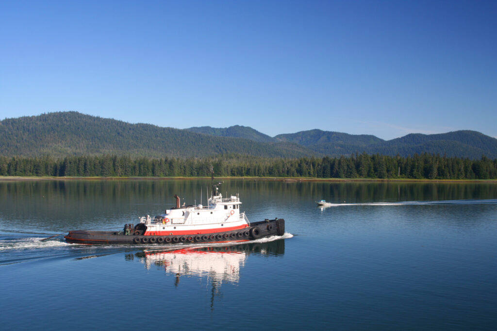
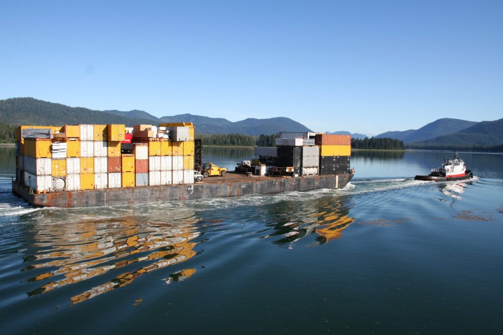
Fishing boats are a natural part of the scene around Petersburg. Smaller commercial vessels, recreational boats and Alaska Marine Highway ferries also use the route.
That helps preserve a very different atmosphere from the cruise ship corridors found near some of Alaska’s larger ports.
Watching working boats move through the channel feels appropriate in Petersburg, a community where commercial fishing remains an important part of everyday life.
Keep Your Eyes on the Shoreline for Wildlife
The Narrows can also be a surprisingly good place to watch for wildlife.
Because vessels travel relatively close to shore in places, passengers can scan both the water and the forest edge.
The Alaska Department of Fish and Game identifies Wrangell Narrows as habitat where visitors may encounter bald eagles, Sitka black-tailed deer, mink, river otters and black bears. Killer whales are also known to travel through the waterway.
Birdlife can be particularly noticeable.
Bald eagles are common around Petersburg and can often be spotted perched in shoreline trees or flying above the water. Herons and kingfishers may also appear around shallower areas.
As anywhere in Alaska, wildlife sightings aren’t guaranteed. The fun is keeping your eyes open.
Fishing Is Part of Life on the Narrows
The Wrangell Narrows aren’t merely a route boats use to get somewhere else.
They’re also part of an active fishing area.
All five species of Pacific salmon can be found seasonally in the greater Petersburg-Wrangell region, along with halibut, rockfish, lingcod and several other species.
One particularly important fishery is associated with Blind Slough on Mitkof Island.
King salmon returning toward the Crystal Lake Hatchery create fishing opportunities in the Wrangell Narrows near the mouth of Blind Slough. Depending on the season, you’ll see anglers taking advantage of that run from both boats and accessible shoreline areas.
Fishing regulations can change by species, location and season, so anglers should always consult the current Alaska Department of Fish and Game regulations before heading out.
Blind Slough Adds Another Reason to Explore South of Petersburg
Visitors interested in seeing more of Mitkof Island can combine an interest in the Narrows with a drive south from Petersburg.
Blind Slough is connected to Wrangell Narrows and is one of the better-known outdoor recreation areas on the island.
The area is associated with fishing, wildlife and the Crystal Lake Hatchery king salmon return.
It also gives visitors another perspective on the waterways surrounding Petersburg without requiring a boat trip through the entire Narrows.
If fishing is part of your plans, check current regulations before visiting. Rules around salmon fisheries can be very specific and may change during the season.
The Narrows Have a Long Maritime History
Long before modern navigation markers and ferries, Indigenous people knew and traveled these waterways.
The original Tlingit name for Wrangell Narrows is recorded as Dakxhatgwak Séet. Another Tlingit name, Gantee Yaak’w Séet, translates to “Steamboat Channel,” reflecting the passage’s later importance to steamship traffic.
The English name has its roots in the Russian colonial period.
In 1838, G. Lindenberg named the waterway “Proliv Vrangelya,” or Wrangell Strait, for Admiral Ferdinand von Wrangell.
For a time, “Wrangell Narrows” referred primarily to the tight central portion of the larger strait. By the early 20th century, the name Wrangell Narrows was being applied to the passage more broadly.
The names may have changed, but the basic reason the waterway mattered did not: it provided an important protected route through this part of Southeast Alaska.
Why Not Just Go Around Mitkof Island?
A glance at a map reveals another passage east of Mitkof Island called Dry Strait.
The name offers a clue about the problem.
The Stikine River carries enormous amounts of sediment toward this area, creating shallow water and constantly changing conditions around its delta. Although Dry Strait may appear to offer a more direct route, its shallows make it unsuitable for much of the marine traffic traveling through the region.
Wrangell Narrows therefore provides an important protected route along the western side of Mitkof Island.
That geography helps explain why Petersburg developed where it did and why maritime navigation remains so central to the community.
Traveling the Narrows by Ferry
One way travelers may experience Wrangell Narrows is aboard an Alaska Marine Highway ferry.
The ferries that serve Petersburg can navigate the passage, giving passengers an opportunity to watch the scenery without having to operate a vessel themselves.
If your route takes you through the Narrows, spend some time outside or near a window rather than treating the journey solely as transportation.
Watch the channel markers. Look for fishing boats. Scan the trees for eagles and the shoreline for other wildlife.
You’ll also get a passenger’s-eye view of the careful route vessels follow through the passage.
Ferry routes and schedules vary, so travelers should check current Alaska Marine Highway information when planning transportation.
Can You Explore Wrangell Narrows Without a Boat?
You don’t necessarily need to travel the full waterway to appreciate it.
Petersburg itself sits along the northern end of the Narrows, so views of the waterway are woven into a visit to town.
Driving south along Mitkof Highway provides additional opportunities to experience the landscape bordering the channel and reach recreation areas farther down the island.
That makes Wrangell Narrows different from an attraction with a single entrance or viewpoint.
It’s part of the geography surrounding Petersburg.
You can encounter it while walking around town, watching boats, fishing, driving Mitkof Island or heading out on the water.
What Makes the Scenery Different from Frederick Sound?
Visitors exploring Petersburg may experience both Wrangell Narrows and Frederick Sound, but the two waterways have very different personalities.
Frederick Sound feels expansive. Mountains rise beyond broad stretches of water, and the area is particularly famous for marine wildlife, including humpback whales.
Wrangell Narrows feels more intimate.
The shorelines are closer. The route twists. Navigation markers appear constantly. Houses, docks and working boats become part of the landscape.
One showcases the enormous scale of Southeast Alaska.
The other puts you inside the details.
Experiencing both gives visitors a much better understanding of the waters surrounding Petersburg.
Photographers Should Look Beyond the Big Landscape
It’s easy to concentrate on mountains and forests when photographing Southeast Alaska, but Wrangell Narrows rewards attention to smaller scenes.
A fishing boat passing a navigation marker can tell more of Petersburg’s story than another wide mountain panorama.
Look for reflections in calm water, eagles perched above the channel, working vessels moving between markers, weather rolling across the hills and the contrast between brightly colored navigation aids and dark evergreen forests.
Changing tides can also dramatically alter the foreground of a photograph over the course of several hours.
Cloudy weather isn’t necessarily a disappointment either. Low clouds and mist often add atmosphere to Southeast Alaska’s waterways.
Don’t Treat the Narrows Like a Recreational Boating Shortcut
Visitors operating their own vessel should understand that Wrangell Narrows requires real navigational preparation.
Strong tidal currents, shallow areas, channel turns and underwater hazards are among the reasons the passage is so carefully marked.
NOAA publishes detailed navigational information for Wrangell Narrows, and mariners should use current nautical charts, tide and current predictions and appropriate navigation resources rather than relying on a tourism article or another boater’s account.
Personal accounts from experienced boaters can provide fascinating insight into what the passage feels like, but conditions differ from one trip to another.
The very things that make Wrangell Narrows interesting to visitors are the same things that demand attention from a vessel’s captain.
Is Wrangell Narrows Worth Exploring?
Wrangell Narrows isn’t a conventional Alaska attraction.
There isn’t a ticket booth, visitor center or single viewpoint where everyone takes the same photograph.
That’s part of what makes it interesting.
The Narrows help explain Petersburg itself.
They are a transportation route, fishing area, wildlife corridor and working waterway. Ferries navigate through them. Fishing boats travel them. Eagles watch from the shoreline. Tides race through the channel while dozens of navigation markers show mariners the safe route ahead.
For visitors interested in seeing Southeast Alaska beyond its headline attractions, that’s reason enough to pay attention.
See the Waterway That Helps Define Petersburg
Petersburg is inseparable from the water around it.
Guests staying at Scandia House can experience that connection in many ways, from watching the fishing fleet around town to exploring Mitkof Island or heading onto the surrounding waterways.
Wrangell Narrows ties much of that story together.
Look south from Petersburg and you’re looking toward a winding marine passage that has guided Indigenous travelers, steamships, fishing boats and modern ferries through Southeast Alaska for generations.
You don’t have to navigate all 21 miles yourself to appreciate it.
Sometimes the best way to understand Petersburg is simply to watch what moves through the water outside it.